3 Zone Option 2
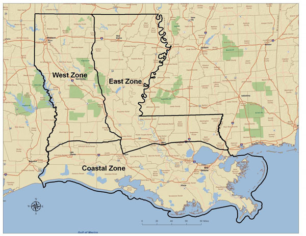
3-zone Option 2 – East, West, and Coastal zones with boundaries described as:
From the Arkansas-Louisiana border south on HWY 167 to Opelousas; thence west on HWY 190 and LA 12 to the Texas state line. From the junction of HWY 167 and HWY 190 south to Lafayette; thence east on I-10 to Baton Rouge; thence east on I-12 to Slidell; thence east on I-10 to the Mississippi state line.
Intentions: This option has the same intentions described in the 3-zone option 1, but provides simplified zone boundaries. The simplified zone boundaries in this option also moves a larger portion of the East zone into the Coastal zone, specifically the habitat south of I-10 from Lafayette to Baton Rouge and south of I-12 from Baton Rouge to Hammond that were traditionally in the East zone would be moved into the Coastal zone.
Information and map image provided by the Louisiana Department of Wildlife and Fisheries


SEE ALL OF THESE AT